08:00
What’s next in spatial epidemiology?
EPID 594
Spatial Epidemiology
University of Michigan School of Public Health
Jon Zelner
[email protected]
epibayes.io
![]()
How do we make spatial analysis useful in the real world?
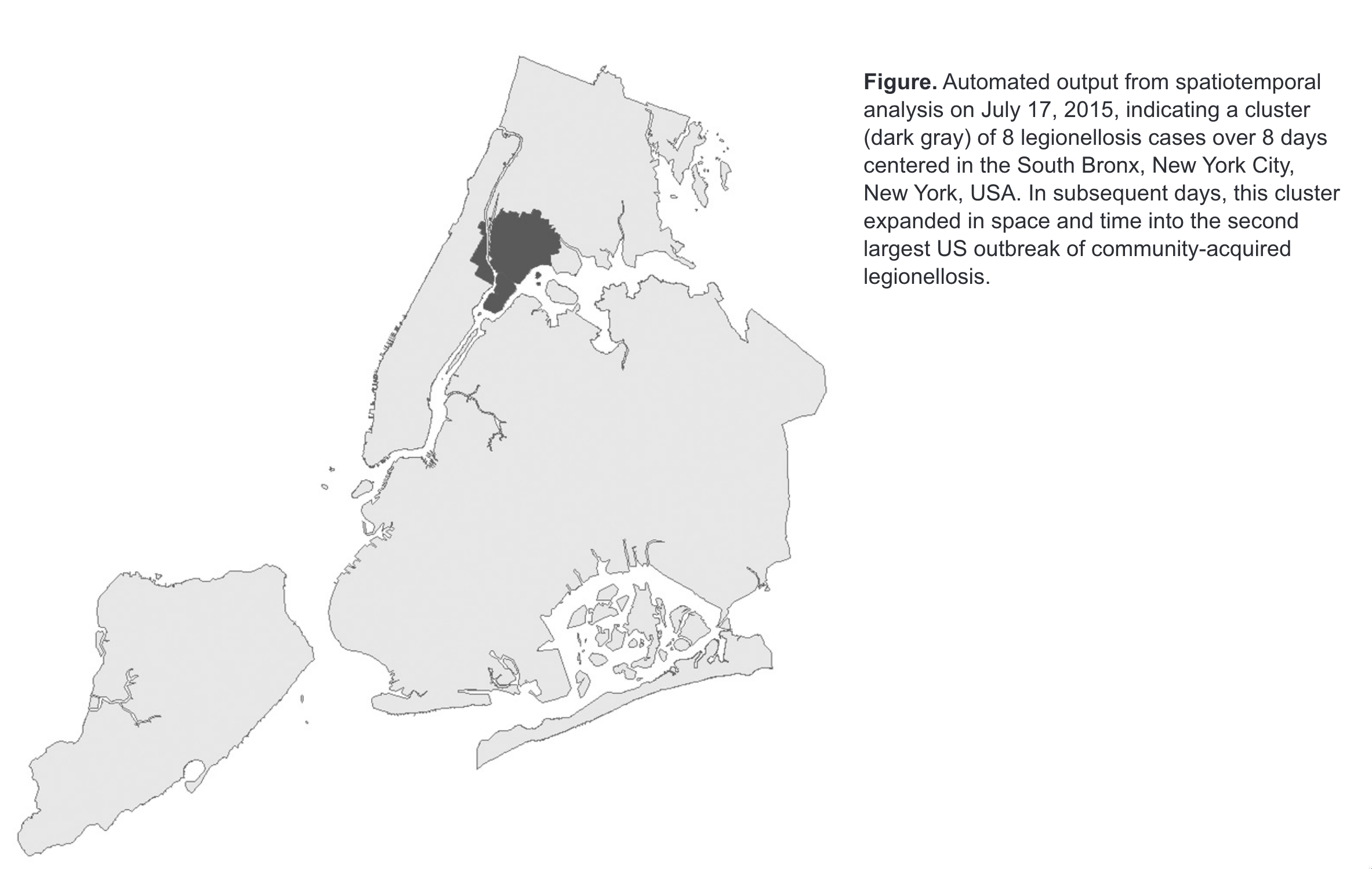
Spatial cluster of Legoinellosis cases identified by automated system (from Greene et al. (2016))
Radon…in space! 🪐
Sometimes spatial epidemiology is a perspective more than a specific result
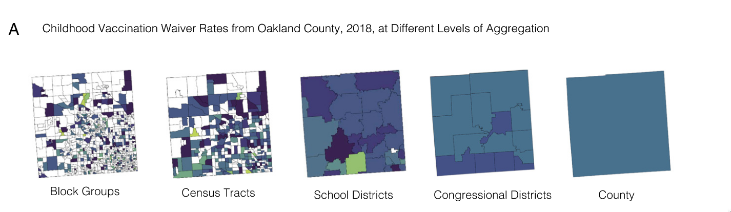
Aggregating across spatial scales obscures clustering of non-vaccination that leads to VPD outbreak risk (from Masters et al. (2020))
Picking the wrong scale of surveillance can lead to predictions that are way off
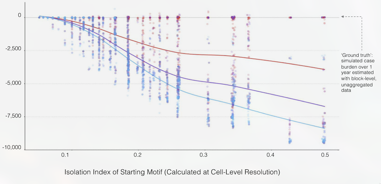
Predictions of outbreak size get worse as spatial aggregation becomes more extreme (from Masters et al. (2020))
Spatial epidemiology’s strength comes from its integrative nature
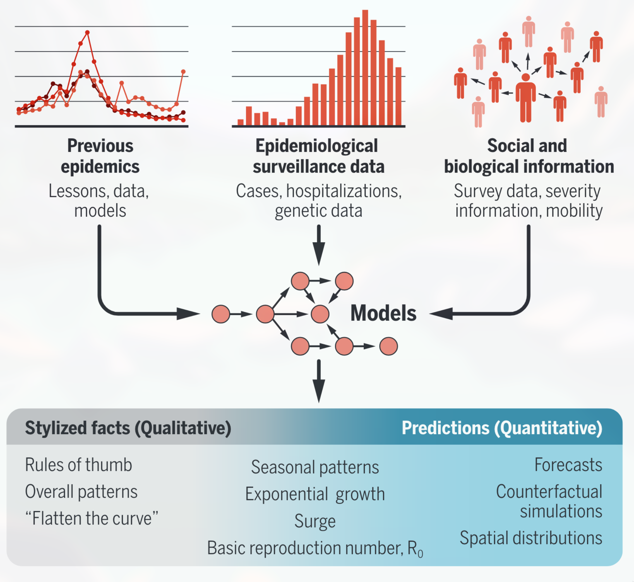
Pipeline from data and theory to epidemiological models (from Zelner and Eisenberg (2022))
Effective spatial epidemiology is focused on understanding how community context and ecology impact risk
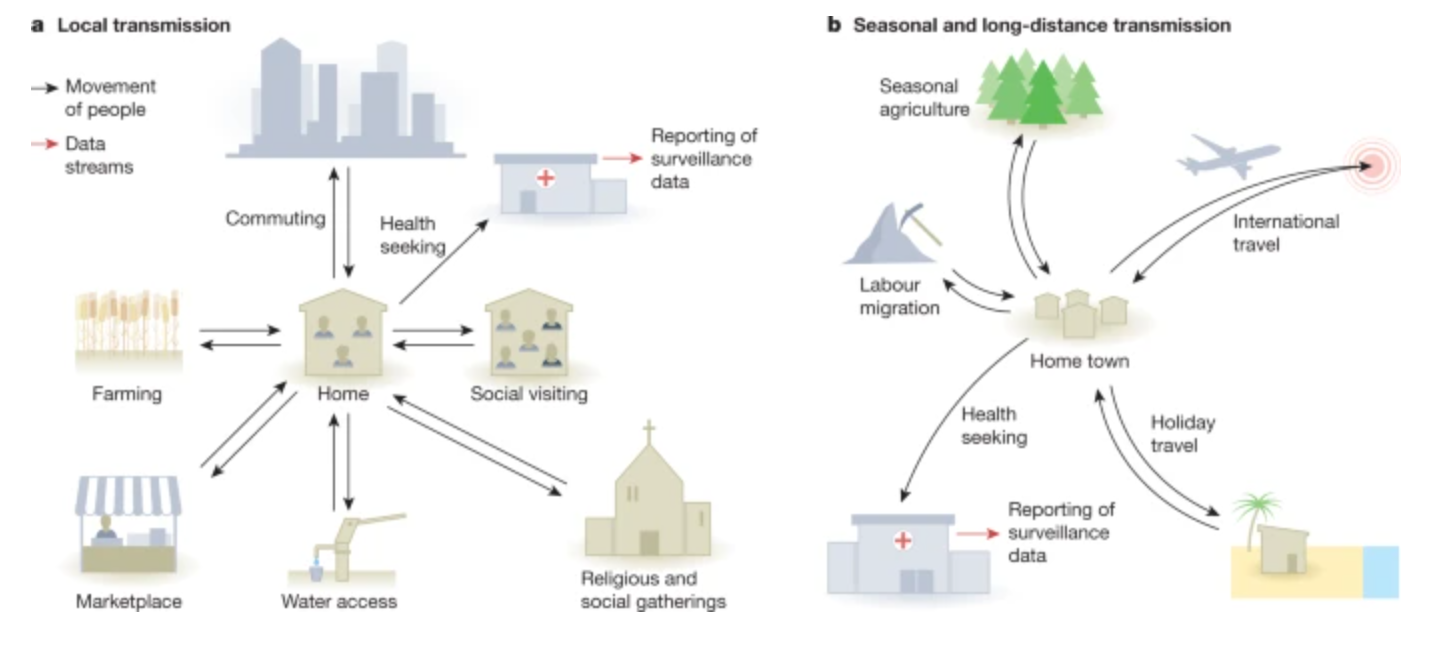
Characterizing the social and ecological determinants of spatial mobility (from Buckee, Noor, and Sattenspiel (2021))